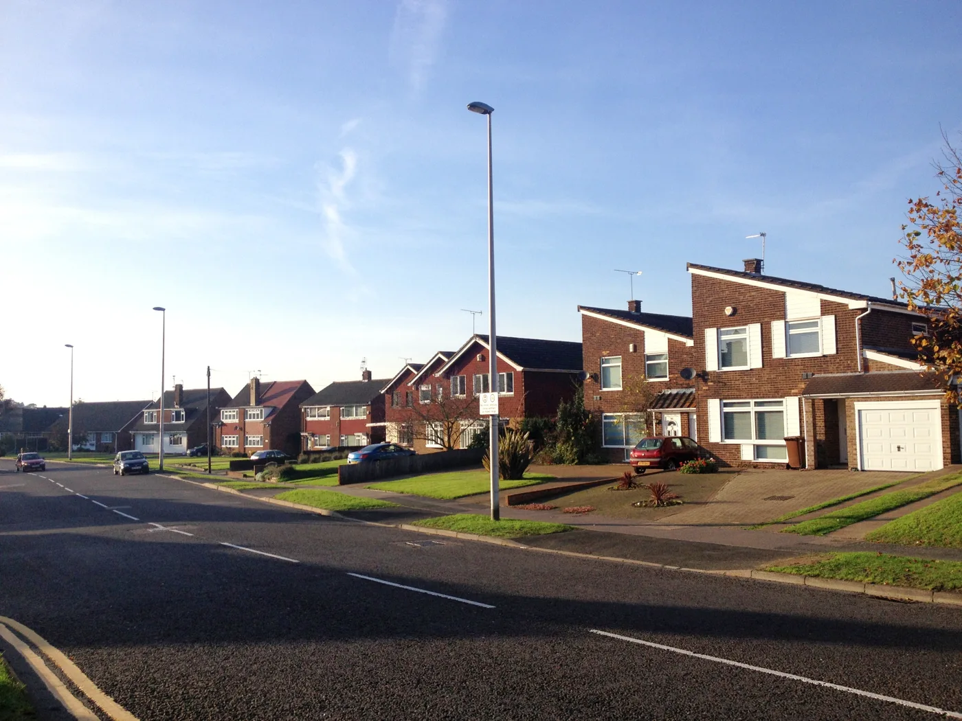

Barratt David Wilson wants up to 360 homes on Green Belt farmland north of Strood, with access off Clinton Avenue and Beaufort Road. Comments close 3 September.
Barratt David Wilson Homes has told Medway Council it intends to apply for up to 360 new homes on farmland north of Rede Court Road in Strood, and has asked the council to agree the scope of the environmental work that will support it. The request was validated on 10 August and is on the council’s planning register as MC/26/1509.
This is not the planning application itself. It is a scoping opinion request, the stage where a developer sets out which environmental effects it proposes to assess and which it wants to leave out. It matters because it is the first public document on a scheme, and it says more about the intended development than most outline applications do at submission.
The site is 16.07 hectares of arable farmland west of Strood, bounded by Gravesend Road (the A226) to the east and by the backs of houses on Fountain Road, Burleigh Close, Romsey Close and Cobb Close to the south. Medway Council’s own constraint record for the application lists it as Metropolitan Green Belt. The scoping report, prepared by Iceni Projects for the housebuilder, describes the land as Grade 2 agricultural land, “representing the highest quality farmland”, currently growing cereal crops.
What is actually proposed
The report sets out up to 360 homes across 9.98 hectares of the 16.07 hectare site, with open space and play provision, a linear green corridor along the northern boundary and a green buffer with sustainable drainage along the southern edge. Maximum building height is given as “approximately 12.5m AOD”, with the report noting that discussions on heights with surrounding stakeholders are still going on.
The detail Strood residents will notice first is the access. Two vehicular entrances are proposed from the south, as extensions of the existing carriageways and footways at Clinton Avenue and Beaufort Road. An east to west route would cross the site and link to a proposed central avenue running from Watling Street (the A2) to Gravesend Road, which is intended to carry bus services. That avenue sits outside this site’s boundary and forms part of the wider masterplan.
The site has no public vehicular or pedestrian access at present. Strood railway station is about 1.9km to the south east.
Part of something much larger
The scoping report is explicit that this is Parcel C of the Land West of Strood strategic allocation, brought forward under a masterplan being prepared jointly with Medway Council and Gravesham Borough Council.
It says Policy SA6 of the emerging Medway Local Plan 2041 identifies Land West of Strood as a cross border development between the two authorities and “makes provision for up to 3,190 new homes, alongside two primary schools, a secondary school, and local community facilities”. This particular parcel is proposed for allocation as SNF1 in the Regulation 19 version of that plan.
So 360 homes is the first slice. The council’s adopted development plan is still the Medway Local Plan of 2003, which covered 1996 to 2006, and the evidence base for the new plan puts local housing need at 24,540 dwellings to 2041, about 1,636 homes a year. Those figures come from the same report.
The timetable the developer is working to
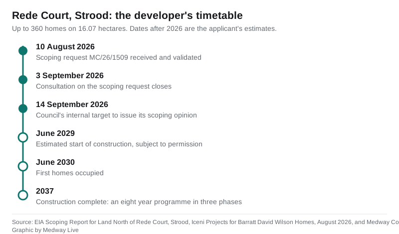
Barratt David Wilson estimates an eight year construction programme in three phases: works starting in June 2029, first occupations in June 2030, and completion in 2037, all subject to planning permission. Nobody is moving in soon, and nobody should assume the scheme will not happen either.
On the scoping request itself, consultation runs to 3 September and the council’s internal target for issuing its opinion is 14 September. The case officer is Amanda Barnes and the ward is Strood North and Frindsbury. The Environment Agency responded on 13 August, attaching its standard Kent and South London scoping advice note rather than site specific objections.
What the developer wants left out of the assessment
Eight topics are proposed to be assessed in full: soils and agricultural land, air quality, ecology, landscape and visual, noise and vibration, socio-economics, transport, and climate change.
Nine are proposed to be scoped out, meaning the environmental statement would not assess them: arboriculture, archaeology, built heritage, water environment and flood risk, ground conditions and contamination, human health, waste, energy and sustainability, and microclimate, along with major accidents and disasters.
Some of those are uncontroversial. The site is in Flood Zone 1, the lowest flood risk category, and is greenfield land with no known contamination history. Others are the kind of thing objectors tend to press on. The report acknowledges two Roman archaeological findspots in the north eastern half of the site, a possible lead alloy gaming piece and a copper alloy brooch, and the line of Roman Watling Street about 250m to the south, but argues any remains would be of low local significance and can be handled by planning condition. It also proposes to remove one tree, categorised as Category C, to form the access.
Nearby designations include Rede Common Local Nature Reserve about 350m south, Great Crabbles Wood Site of Special Scientific Interest about 1.1km north west, and the North Kent Marshes special protection area about 4.5km north, inside the 6km buffer where recreational disturbance to over wintering birds has to be assessed.
What it means for you
If you live on Rede Court Road, Fountain Road, Burleigh Close, Romsey Close, Cobb Close, Clinton Avenue or Beaufort Road, this is the document to read now rather than in two years. The two roads named as access points would change from residential culs de sac into entrances serving hundreds of homes, and that is settled at outline stage, not later.
You can comment on the scoping request through the planning portal entry for MC/26/1509 until 3 September. Be aware what this stage decides: comments here shape which environmental effects get assessed, not whether the homes are approved. If you think transport modelling should cover a junction the report has not mentioned, or that the heritage or health assessments should not be dropped, now is when saying so counts.
The full application will follow with its own consultation, and we will cover it. In the meantime you can track new applications across the district on our Medway planning applications page and read our planning news coverage, and if you are weighing what this does to the area, our Medway house prices page carries the latest Land Registry figures for the district.
Contact details, the full 97 page scoping report and the Environment Agency response are all on the council’s Public Access portal.
Have your say